Plot ZipCode Boundaries on a Map: Part 2 - Import Zip Code (U.S. Census ZCTA) Data Into A Database
Jun 24, 2008 • Chris Pietschmann • MappingNow that we’ve Made Sense of the U.S. Census ZCTA ARC/INFO Ungenerate (ASCII) files in Part 1 of this series, we are ready to import the U.S Census ZCTA Zip Code data into a database. In Part 2, we’ll create database tables and import the Zip Code Boundary data into those tables in a MS SQL 2005 database.
Create SQL 2005/2008 Database Tables
First lets create a couple database tables to hold all the Zip Code boundary data. One table will hold the ZipCodes, the other will hold all the Boundary Points for each Zip Code.
The table scheme is as follows:
ZipCode
 ID - uniqueidentifier
 ZipCode - char(5)
ZipCodeBoundary
 ID - uniqueidentifier
 ZipCodeID - uniqueidentifier
 IslandID - int
 Latitude - float
 Longitude - float
 SortOrder - int
Here’s a couple things to not about the ZipCodeBoundary table:
- The *IslandID* field numbers each "island" or "zone" for that specific zipcode's boundary. An island is an area within the zipcode that is omitted from the zipcode, or an island of land that is to be included within the zipcode that doens't physically touch the main part of the boundary. The main boundary is going to have an IslandID value of 0 (zero).
- The *SortOrder *field numbers each boundary row in the order they appeared in the ARC/INFO Ungenerate (ASCII) file.
Here’s the SQL code for creating these tables. For this article, I created these tables in a database named ZipCodeBoundaries.
USE [ZipCodeBoundaries]
GO
/****** Object:  Table [dbo].[ZipCode]    Script Date: 06/24/2008 15:40:28 ******/
SET ANSI_NULLS ON
GO
SET QUOTED_IDENTIFIER ON
GO
SET ANSI_PADDING ON
GO
CREATE TABLE [dbo].[ZipCode](
    [ID] [uniqueidentifier] NOT NULL,
    [ZipCode] [char](5) COLLATE SQL_Latin1_General_CP1_CI_AS NOT NULL,
 CONSTRAINT [PK_ZipCode] PRIMARY KEY CLUSTERED
(
    [ID] ASC
)WITH (PAD_INDEX  = OFF, STATISTICS_NORECOMPUTE  = OFF, IGNORE_DUP_KEY = OFF, ALLOW_ROW_LOCKS  = ON, ALLOW_PAGE_LOCKS  = ON) ON [PRIMARY]
) ON [PRIMARY]

GO
SET ANSI_PADDING OFF
GO
/****** Object:  Table [dbo].[ZipCodeBoundary]    Script Date: 06/24/2008 15:40:43 ******/
CREATE TABLE [dbo].[ZipCodeBoundary](
    [ID] [uniqueidentifier] NOT NULL,
    [ZipCodeID] [uniqueidentifier] NOT NULL,
    [IslandID] [int] NULL,
    [Latitude] [float] NULL,
    [Longitude] [float] NULL,
    [SortOrder] [int] NULL,
 CONSTRAINT [PK_ZipCodeBoundary] PRIMARY KEY CLUSTERED
(
    [ID] ASC
)WITH (PAD_INDEX  = OFF, STATISTICS_NORECOMPUTE  = OFF, IGNORE_DUP_KEY = OFF, ALLOW_ROW_LOCKS  = ON, ALLOW_PAGE_LOCKS  = ON) ON [PRIMARY]
) ON [PRIMARY]
Import Data Into Database Tables
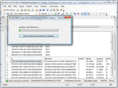
 To make things easier, I wrote a small utility that reads in the “a.dat.csv” and “.dat.csv” files generated in Part 1 of this series and imports the data into the table defined above. One thing to note when importing the data from these file (and the original ARC/INFO Ungenerate (ASCII) files) is that each set of files starts numbering the ZipCodes at 1. So when importing into the database we much give each Zip Code a unique ID (in this article I’m using GUID’s for this) and setting that ID correctly for each of the Zip Code Boundary Points.
Download the Import Utility: ImportARCINFOASCIIToSql05Database.zip (15.18 kb)
Remember, that when running this utility, it can take awhile to import ALL the ZipCode Boundary data for the entire country.
Note, this example utility has the connection string hard coded in the Form1.cs code file. Don’t forget to change it to point to your database, unless you create your database on the local SQL Express instance and name it “ZipCodeBoundaries” like I do in this article.
Prev Part: Part 1 - Making sense of U.S. Census ZCTA ARC/INFO Ungenerate (ASCII) files
Chris Pietschmann
DevOps & AI Architect | Microsoft MVP | HashiCorp Ambassador | MCT | Developer | Author
I am a DevOps & AI Architect, developer, trainer and author. I have nearly 25 years of experience in the Software Development industry that includes working as a Consultant and Trainer in a wide array of different industries.


